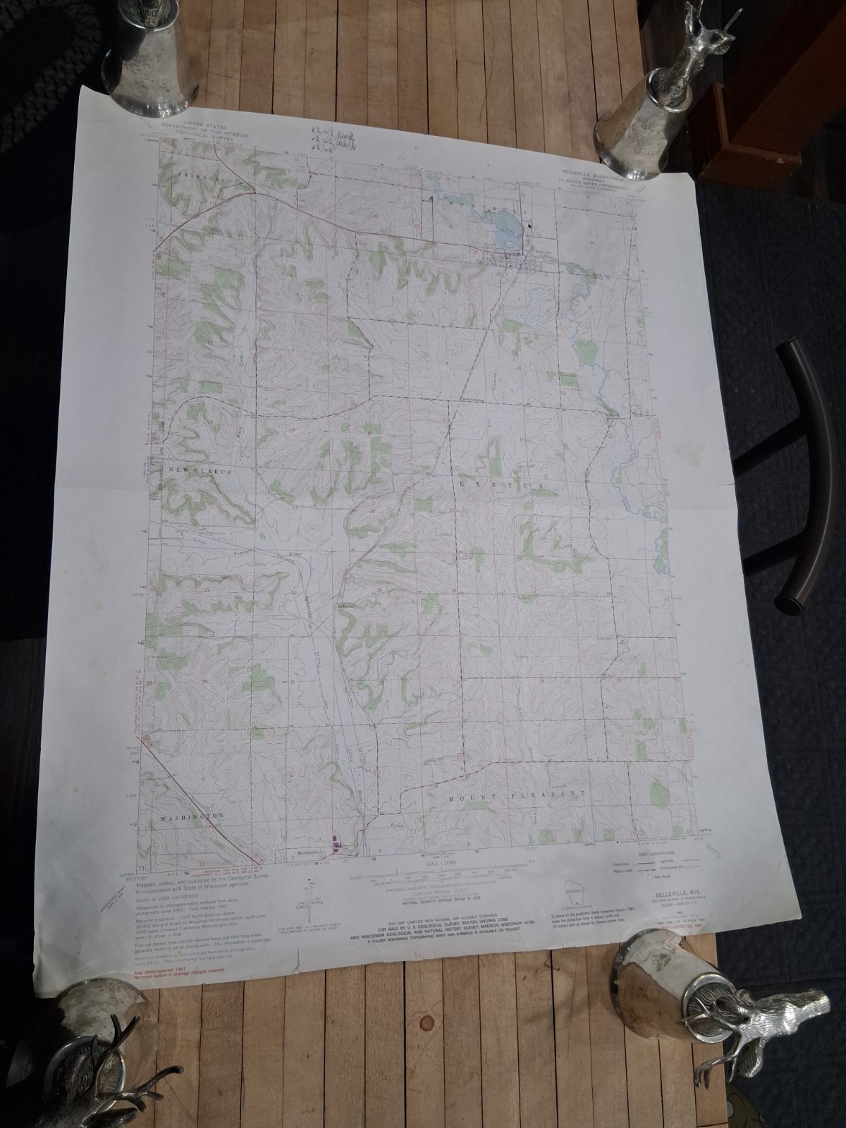
Long before GPS could recalculate itself into a cornfield, surveyors, engineers, hunters, hikers, farmers, and local officials relied on detailed topographic maps like this one to understand the landscape beneath their feet. This original U.S. Geological Survey map depicts the Belleville, Wisconsin quadrangle and carries a 1981 photoinspection date with revisions shown from earlier surveys and aerial photography. Measuring approximately 27 x 22 inches, it provides a remarkably detailed look at the rolling terrain, waterways, roads, elevations, section lines, and rural features surrounding Belleville and the surrounding Dane and Green County region. Contour lines ripple across the sheet like fingerprints of the land itself, revealing hills, valleys, ridges, and drainage patterns that remain largely invisible from ground level. Communities, roads, streams, quarries, cemeteries, and landmarks are all carefully plotted in the precise cartographic language that made USGS maps the gold standard for decades. The sheet remains highly readable, with crisp printing and the classic color palette familiar to map collectors and outdoor enthusiasts alike. Signs of age, handling wear, fold lines, edge wear, and light creasing are present and consistent with a working vintage map. The larger format creates an impressive visual presence whether displayed framed or preserved in an archival collection. It is both a practical geographic document and a snapshot of southern Wisconsin during a specific moment in time. Original government-issued maps continue to attract collectors for their historical accuracy and regional significance. This example offers a particularly appealing connection to the Belleville area and surrounding countryside.
Modern mapping often hides the landscape beneath layers of screens, menus, zoom levels, advertisements, notifications, and enough digital clutter to make finding a hill feel like filing taxes. A vintage USGS map does the opposite. Every contour, stream crossing, township line, and elevation mark exists for a reason, placed by people whose job was to measure reality rather than persuade it to click on something. The result is a document that rewards patience and curiosity. Spend a few minutes tracing roads and creek beds and entire stories begin emerging from the paper. Forgotten routes appear. Small settlements reveal their relationships to rivers and ridges. The terrain explains why roads curve where they do and why towns emerged where they did. Cartographers managed to turn raw geography into something that is simultaneously scientific and beautiful. Collectors increasingly seek these maps because they preserve a version of the landscape before constant development altered portions of it. Historians value them for their accuracy. Outdoorsmen appreciate them for their practicality. Decorators frame them because contour lines possess a strange artistic quality that no mass-produced wall print can imitate. Unlike generic décor designed by committee, this map earned every line through actual measurement and observation.
Belleville sits within a landscape shaped by rivers, glacial forces, rolling hills, and generations of Wisconsin history. This map captures that landscape not as a tourist destination but as a living geographic record. The valleys, streams, ridges, roads, and communities shown here represent thousands of years of natural processes intersecting with human settlement. Every contour line marks a rise or fall in the earth that someone once climbed, farmed, crossed, surveyed, or called home. Folded into a drawer, displayed in a study, framed in an office, or preserved within a regional history collection, it remains a tangible connection to place. Collectors of Wisconsin history often seek quadrangle maps because they reveal details that disappear from broader state maps. Genealogists, local historians, landowners, and outdoor enthusiasts find themselves returning to them again and again. There is something satisfying about seeing a landscape reduced to ink, symbols, and measured lines while still retaining its personality. Long after technologies change, paper maps continue telling the story of how people understood the ground beneath them. This sheet preserves one chapter of that story centered on Belleville and the surrounding countryside. It stands as both a practical reference and a historical artifact from an era when understanding the land required reading it rather than searching for it.
🗺️ Original USGS topographic survey map
📍 Belleville Wisconsin quadrangle
🏞️ Detailed contour and elevation data
🧭 Roads waterways and landmarks shown
📜 Photoinspected 1981
🏛️ Government-issued cartographic document
🖼️ Suitable for framing or collection
📦 Pre-owned
📏 27 x 22 in
All items are sold as is with no returns, no exceptions. These are vintage or custom pieces that will not be perfect unless noted otherwise. Flaws and age should be expected. Any questions, please ask. If shipping to Alaska, Hawaii, or Puerto Rico please contact me first or your order may be cancelled.
Combined shipping is available, please contact me for details.
Please view all pictures before purchase. If there are any questions regarding a product, please reach out. Our policy is to answer your questions within 24 hours, most times significantly less.
If there is a problem with the purchase, please reach out before leaving a negative review. Our goal here is to have a positive experience with each transaction, and we hope to work together to resolve any issues.
Our shipping policy is to always ship via the lowest shipping cost available. If you wish for expedited shipping, please reach out and we\'ll do what we can to accommodate. It is also policy to have your package in the mail within 24 business hours. If you purchase before 2pm Central Time, your package will most likely go out that day. Please check your tracking numbers to view where your package is currently in transit. We have no control over delivery speed once item has been dropped off.Colors have been sharpened on some images to show item detail and may reflect in slightly dimmer appearance in real life.The first image has been digitally sharpened to better show details, this at times causes a slight change in the color, please be aware of this, and check all photos.
Items shipped to Alaska, Hawaii, and Puerto Rico must be pre-approved before purchase. Failure to do so could result in the cancellation of the order.

Related Items:

Belleville WI Wisconsin c1910 Mckeen Motor Car Trolley RPPC Photo Postcard COPY
$4.95

Belleville, Wisconsin 1965: Giant Potatoes and Beautiful Country Postcard
$9.95
Belleville Wisconsin USGS Topographic Survey Map 1981 27 x 22
$11.31