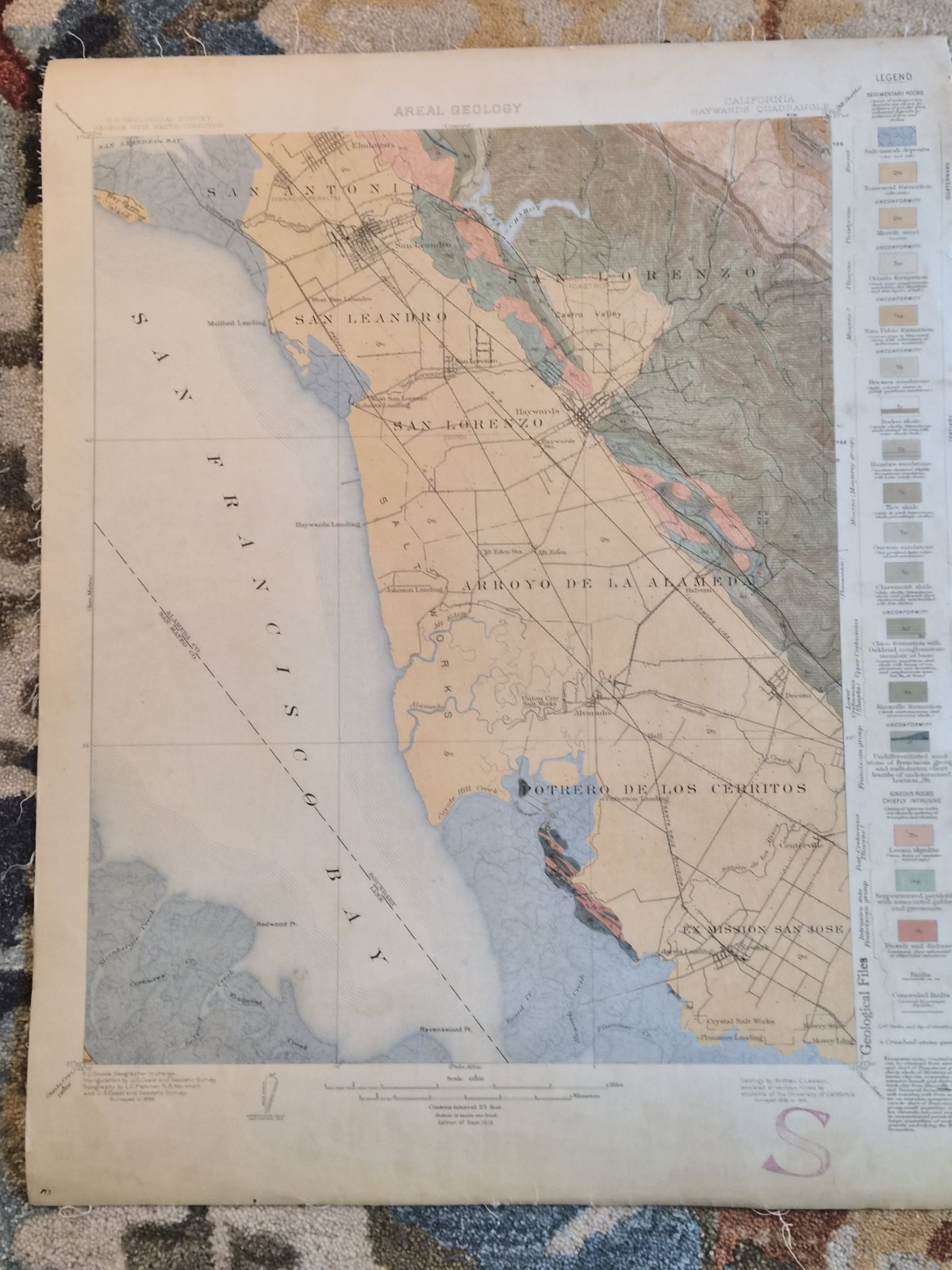
Original U.S. Geological Survey geological map of the Hayward Quadrangle, California, issued in September 1913. Covers portions of the eastern San Francisco Bay region including Hayward, San Leandro, San Lorenzo, Castro Valley, Mission San Jose, and surrounding areas.
This detailed color geological map identifies rock formations, sedimentary deposits, fault zones, topographic features, waterways, transportation routes, and historic place names from the early twentieth century.
Professionally cloth-backed for durability and bears a Michigan State College Department of Geology and Geography stamp on the reverse, indicating academic or institutional use.
A desirable piece for collectors of California history, geology, cartography, USGS publications, and antique scientific maps.
Condition: Vintage condition with age-related toning, edge wear, and fraying to portions of the cloth backing. Please review all photographs carefully for exact condition.
Details:
U.S. Geological Survey
Hayward Quadrangle, California
Edition of September 1913
Scale 1:62,500
Cloth-backed
Original period issue, not a reproduction
Map will be rolled and shipped in a tube.

Related Items:

Antique 1913 Improved Order of Red Men Archive Lot Renovo PA RPPC Photo Ledger
$125.00
Antique 1913 Philadelphia Diocesan School Board Attendance Certificate Framed
$39.99
Antique 1913 California Souvenir Playing Cards – M. Rieder – w/ Box & Insert
$30.00