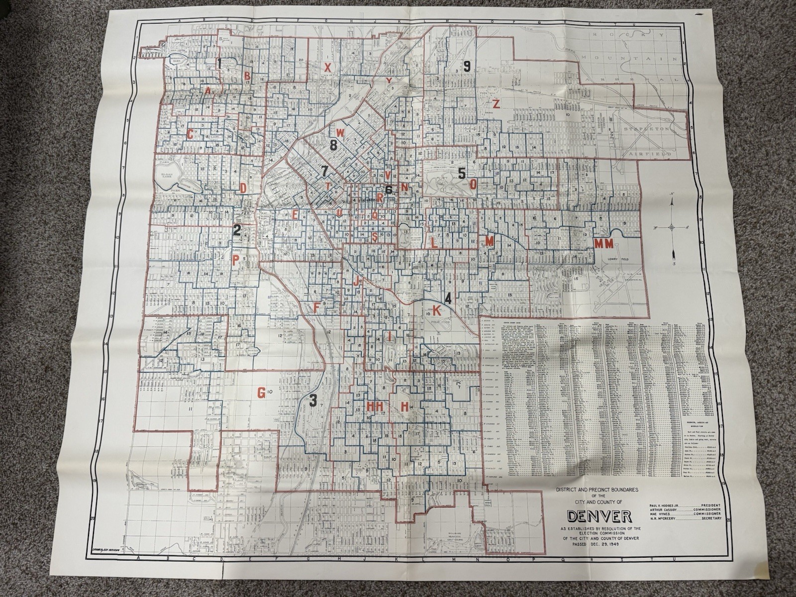
Original 1949 District and Precinct Boundaries Map of the City and County of Denver, Colorado, issued by the Election Commission of the City and County of Denver following the resolution passed December 29, 1949.
This large-format municipal map illustrates Denver’s voting precincts, district boundaries, major streets, parks, public buildings, schools, rail lines, and the city’s layout during the post-war era. Also includes an extensive alphabetical street index with corresponding precinct references, making it an outstanding research piece for historians, genealogists, city planners, and collectors of Colorado ephemera.
Notable landmarks shown include Stapleton Airfield, City Park, Cheesman Park, Washington Park, the State Capitol, University of Denver, Wellshire Municipal Golf Course, and many other historic neighborhoods and public institutions as they existed in 1949.
Measures approximately 42” x 38”.
Condition:
Original folded issue. Displays well with expected fold lines from storage. Light handling wear and minor edge wear consistent with age. No major tears, repairs, or significant losses noted. Please review all photographs carefully as they are part of the description.
A scarce and highly displayable piece of postwar Denver history that would make an excellent addition to any collection of Colorado maps, municipal planning material, political history, genealogy, or historic Western ephemera.

Related Items:
1949 Denver Colorado MOTORCYCLE License Plate # 1-1110
$149.99
1949 Denver Colorado VotingPrecinct Map Election CommissionOriginal 42x38
$225.95
1949 Denver North High School "Newspaper" "The North Star" Original Vintage Rare
$14.95