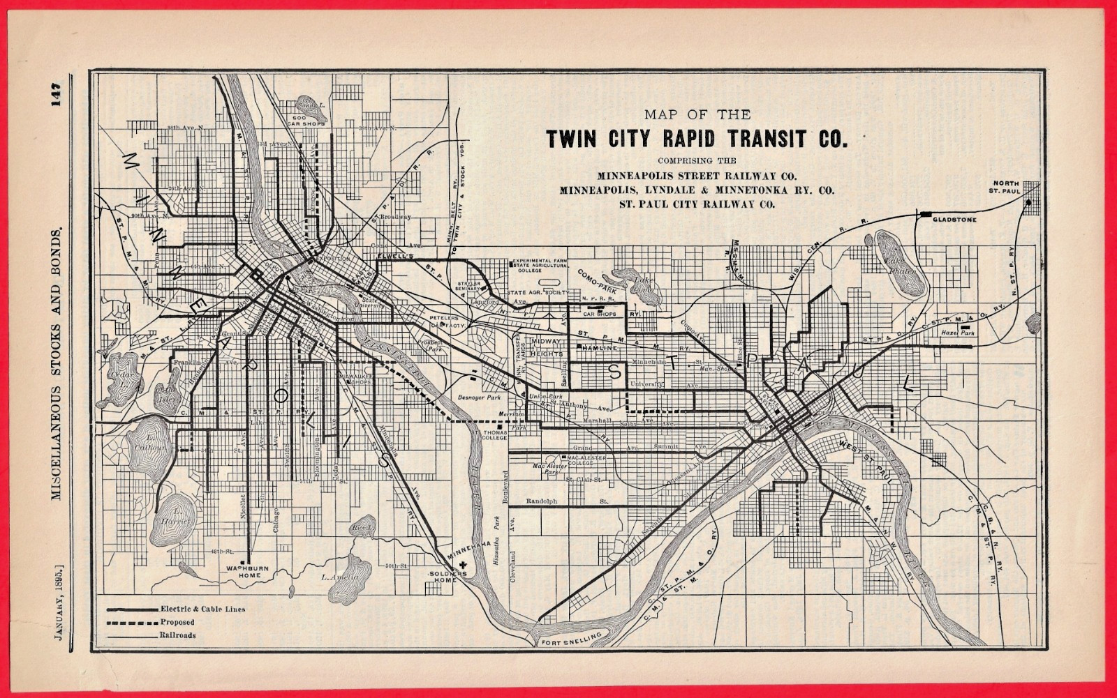
Title: Map of the Twin City Rapid Transit Co. Comprising the Minneapolis Street Railway Co., Minneapolis, Lyndale & Minnetonka Ry. Co., St. Paul City Railway Co.
Date: January 1895
Source: Extracted from the Investors' Supplement of the Commercial and Financial ChronicleSize: Approx. 8" x 12.5."
Original 1895 financial supplement map showing the layout of the Twin City Rapid Transit Company. This historic piece maps out the early, rapidly growing electric streetcar lines across Minneapolis and St. Paul, Minnesota, during a foundational era of Midwestern urban transit consolidation under Thomas Lowry.
As an authentic plate from the premier financial journal of the Gilded Age, the Commercial and Financial Chronicle, this map provides a fascinating historical snapshot of the network's infrastructure as presented to Wall Street investors over 130 years ago.
• Overall Condition: Very Good for its age.• Details: Cleanly extracted from the original supplement. Paper remains bright with crisp printing and clear line work.• Conservation Note: There is a minor 1-inch tear in the upper left corner. This has been professionally stabilized and mended using high-quality, acid-free archival tape applied carefully to the verso (backside) to prevent further handling wear. The front display area remains neat and highly presentable. Please review the high-resolution photos to verify the details and condition.
700 Our 27th year on

Related Items:
1895 Twin City Rapid Transit Co. Map Minneapolis St. Paul Street Railway
$45.00
1895 Richmond Cavendish Co Twin Clouds Tobacco Trademark Registration
$13.49

Antique P&A Royal GWTW Lamp Matching Chrysanthemum 25.5 Non-Electrified 1895"
$325.00