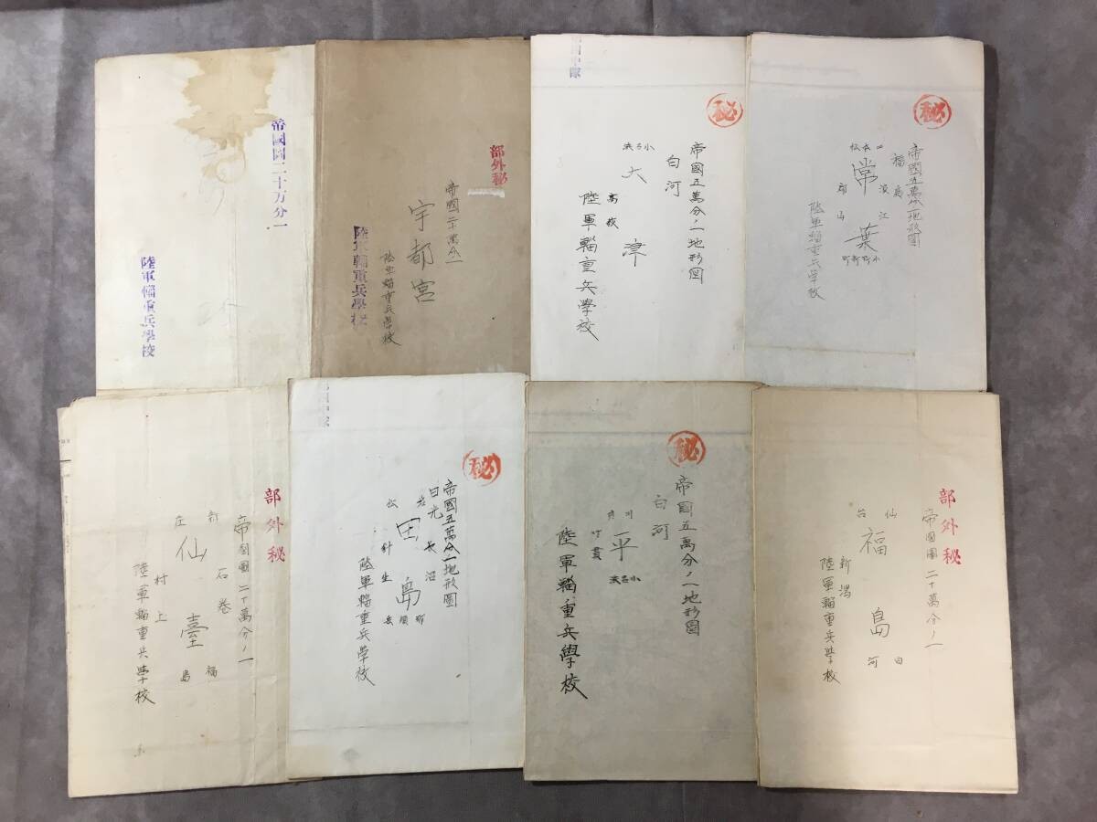
DescriptionThe Other Side of War: The Men Who Kept an Army MovingThis is a collection of eight original Japanese topographic maps associated with the Imperial Japanese Army during World War II.Several maps bear the Japanese marking “Restricted” (部外秘), and the reverse sides include inscriptions identifying the Imperial Japanese Army Transport Corps School. Some maps also retain their original printing and publication dates from 1939.But what exactly was the Transport Corps School?When we think of World War II, we often picture fighter planes, tanks, and soldiers on the front lines.But even the most powerful army cannot keep fighting without food, ammunition, fuel, and equipment.Behind every advancing army were people responsible for getting those supplies where they needed to go.In the Imperial Japanese Army, this essential work was carried out by the Transport Corps, known in Japanese as the Shichohei.The Imperial Japanese Army Transport Corps School trained personnel in the knowledge and skills needed for military transportation and supply. The school ceased to exist following Japan’s surrender in 1945.These eight maps depict various regions of Japan, including Utsunomiya, Otsu, Sendai, Shirakawa, and Fukushima.Mountains, rivers, roads, railways, and small towns are shown in remarkable detail.Today, we can find almost any location with a smartphone. But more than 80 years ago, military personnel had to unfold paper maps and carefully interpret the landscape themselves.Who might have studied these maps all those years ago?Perhaps someone was planning a transportation route. Perhaps a young soldier was learning how to read the terrain for the first time.We cannot know exactly how these particular maps were used, but the school inscriptions and surviving markings offer a fascinating connection to Japanese military education.These are not glamorous medals or possessions of famous generals.Instead, they preserve a quieter side of military history: the work of ordinary people whose efforts helped keep an army moving.Item Details* Set of eight vintage Japanese topographic maps
* Associated with the Imperial Japanese Army
* Several marked “Restricted” (部外秘)
* Inscriptions identifying the Imperial Japanese Army Transport Corps School
* Some maps dated 1939
* Various handwritten markings and inspection stamps
* Age-related folds, discoloration, stains, tears, and old repairsPlease examine the photographs carefully for the condition and details of each map. Their precise use at the school and the dates of any handwritten annotations have not been independently verified.These are more than old maps of Japan.They offer a tangible connection to military transportation, logistics, and the people who studied the geography of their country during a turbulent period of history.Because history does not survive only on the battlefield.Own a Piece of History.Shipping
FedEx or Japan Post
International Buyers - Please Note:
Import duties, taxes, and charges are not included in the item price or shipping cost.These charges are the buyer\'s responsibility.Please check with your country\'s customs office to determine what these additional costs will be prior to offerding or buying.
Provided by HARU

Related Items:
WWII Imperial Japanese IJN Navy M44 Steel Shin-Yo Helmet
$8995.00
Rare WWII Imperial Japanese Occupation Proclamation – Shanghai, 1940s
$2300.00
WWII Imperial Japanese Navy Hiryu Aircraft Carrier Launch Dishes 2pc Set
$1200.00