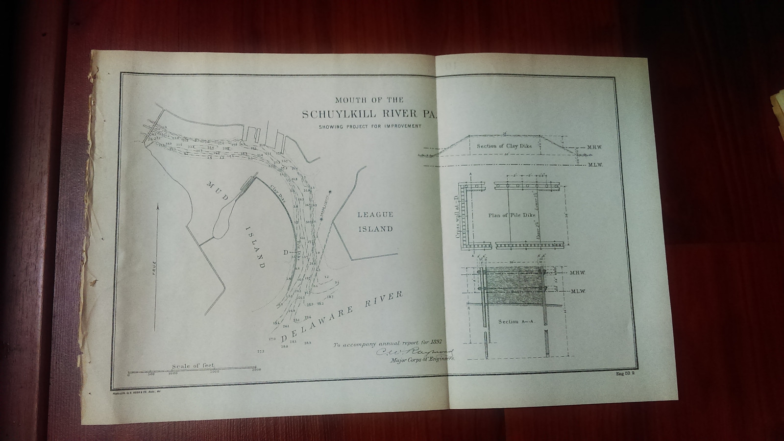
Army Engineering map or diagram that was removed from a bound historical book of documents and maps. Since our maps can vary greatly in condition (i.e. some maps MAY have edge tears and/or separating seams), please view images carefully. This map was removed from a historical bound book of maps and documents printed by the U.S. Government Printing Office.
Map comes folded (on current seams) when we ship it.
Measures about 14in. by 9in.
(map #1833)All Original Maps and Diagrams are crisp and sharp. Some of our low resolution photos come across as blurry.
Please check out our store MEMAPS for thousands ofAntique Original Foldout Maps, Diagrams, and Plates including, Canals - Dikes - Rivers- Lakes- Harbors - Dredging- Flood Control- Concrete Piers - Dams Levees- Forests - National Parks - Railroads- Military Ordnance - Naval- Nautical - Topographical- Geographical - Mining -Tunnels - Bridges- Architectural Engineering- Reservations U.S.Territories - Wharfs – U.S Army Corps of Engineers Surveys.
We offer a 100% satisfaction guarantee on all purchases.

Related Items:
Vintage Map of Chicago Illinois 1892 Travel Poster Print
$11.05
Vintage 1892 INYO KERN TULARE CTY CALIFORNIA Map 22"x14" Old Antique BAKERSFIELD
$39.62
Vintage 1892 SAN FRANCISCO CA Map 22"x14" Old Antique Original MISSION DISTRICT
$45.72